Urban Morphology Toolkit using Grasshopper
This project documents the development of a Grasshopper toolkit designed for the analysis of urban morphology parameters.
Project Overview
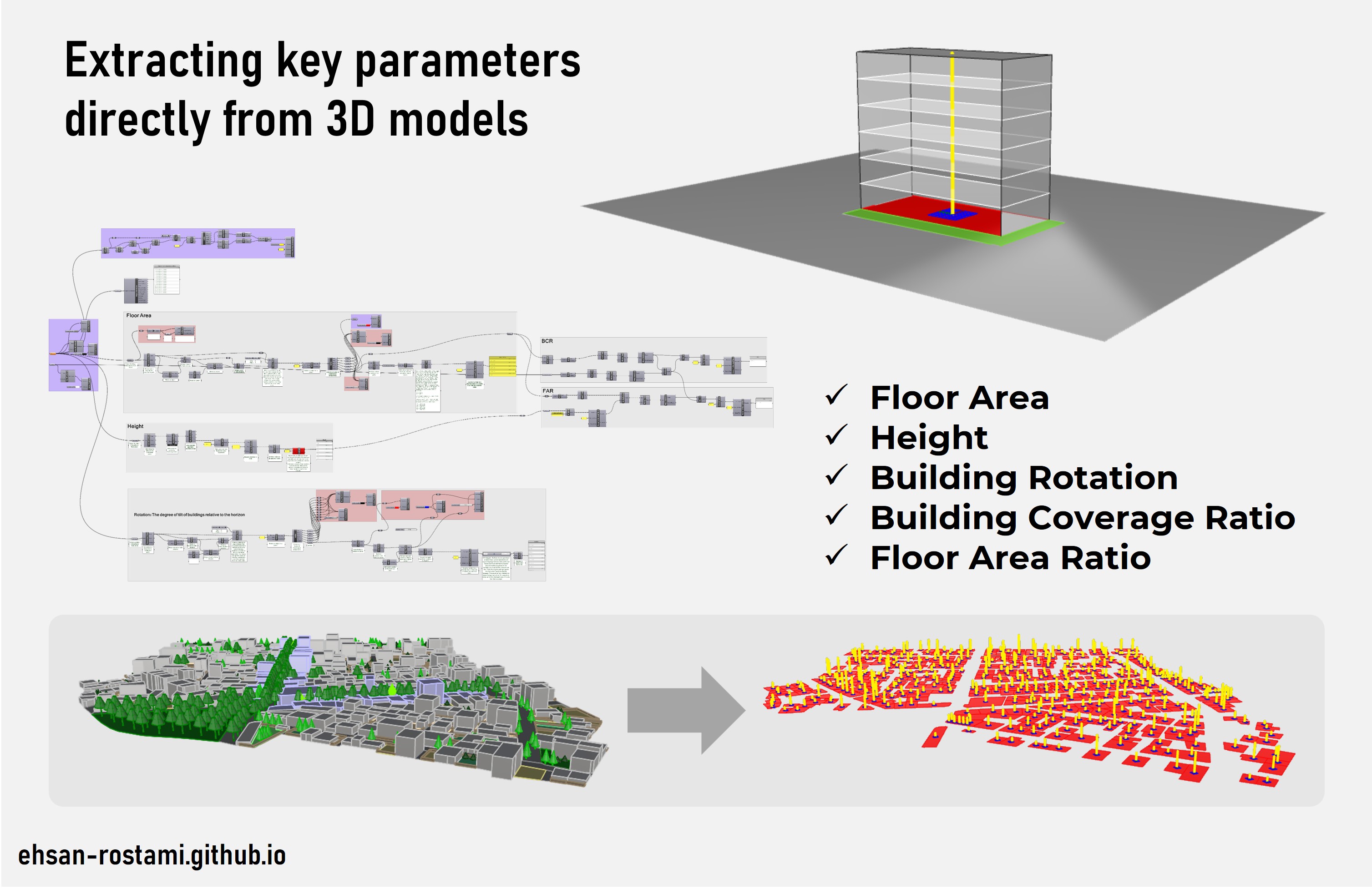
Precise quantification of urban morphology is crucial for understanding microclimate behavior, but manual measurement can be time-consuming. These algorithms automate the process, extracting key parameters directly from 3D models for efficient and detailed analysis.
Methodology
- Parameter Identification: Developing algorithms to extract information on Floor Area, Height, Building Coverage Ratio (BCR), Floor Area Ratio (FAR) and building rotation of each building
- GIS-Free Workflow: Designed to function effectively without dependency on GIS data, these algorithms rely on architectural data.
Key Innovation
The primary innovation lies in the creation of automated tools that can rapidly extract key urban morphology parameters from 3D models. This enables researchers and designers to analyze urban environments quickly and quantitatively.
Key Findings
These algorithms have been successfully used to model the urban core of Ilam city and can help us to quantify impacts of different urban morphological parameters on urban climate, energy consumption, and access to light.
Related Publications and Works
- This project is directly related to publications on the impact of urban morphology on solar potential, energy consumption, and daylight autonomy. Please see the Publications page for more information.
- Efforts are underway to package these algorithms into a user-friendly Grasshopper plugin for wider dissemination and application.